|
Butte's Piss & Moan Runners' guide to runable roads/trails in our area.
Each trail includes directions to the site, and a brief description of the
trail. |
|
Trail |
Map |
GPS Route |
Length |
Difficulty Rating |
Normally Free of Snow |
|
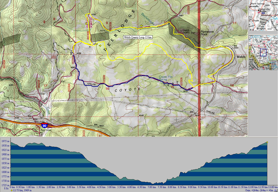
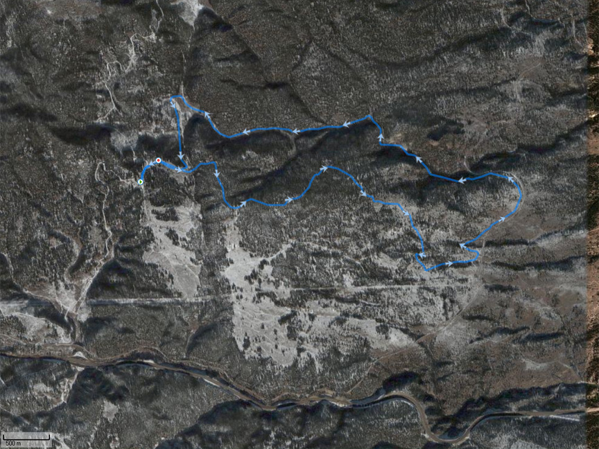
Welch Quarry Loop |
Topo
Photo |
13K.tpo |
13 km |
Moderate with single and double track Some erosion
causing tricky footing |
May through October, with snow and ice lingering in areas of northern
exposure |
|
Ringing Rocks Loop |
Topo
Photo |
13K.tpo |
13 km or
more |
Moderate with single and double track
and some tricky footing, esp with snow/ice. |
Most of year except during winter storms |
|
Dirt Road From Pipestone to Whitehall |
Topo
Photo |
19K.tpo |
12 km or
19 km |
12 km - Easy net downhill
with good footing.
19 km - Adds some climbing. |
All year except during winter storms |
|
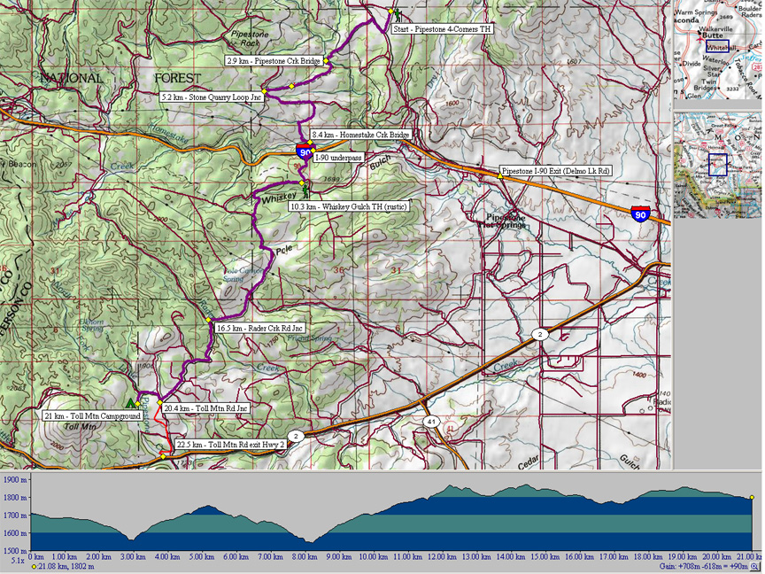
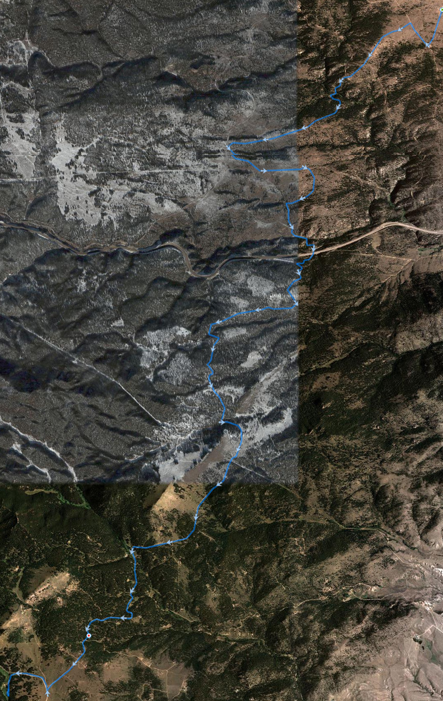
Pipestone to Toll Mountain |
Topo
Photo |
21K.tpo |
21 km |
21 km - Difficult trail and
dirt road with lots of hills. |
May through October, with snow and ice lingering in areas of northern
exposure |
|
Waterloo to Mill Canyon to Rock Creek Trail |
Topo
Photo |
19K.tpo |
14 km or
19 km |
14 km - Flat then moderate
climb on dirt road.
19 km - Adds difficult trail
climb. |
Memorial Day through Columbus Day, with snow and ice lingering in high
areas with northern exposure. |
|
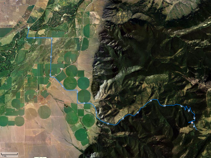
Curly Creek Trail to Rock Creek Trail |
Topo
Photo |
27K.tpo |
27 km
|
27 km - Difficult trail with areas of rough footing
and a "Braveheart" type mountain ascent/descent. |
Officially opens 15 July
and normally stays open through Labor Day, with snow lingering in high
areas. |