|
Butte's Piss & Moan Runners' guide to runable roads/trails in our area.
Each trail includes directions to the site, and a brief description of the
trail. |
|
Trail |
Map |
GPS Route |
Length |
Difficulty Rating |
Normally Free of Snow |
|
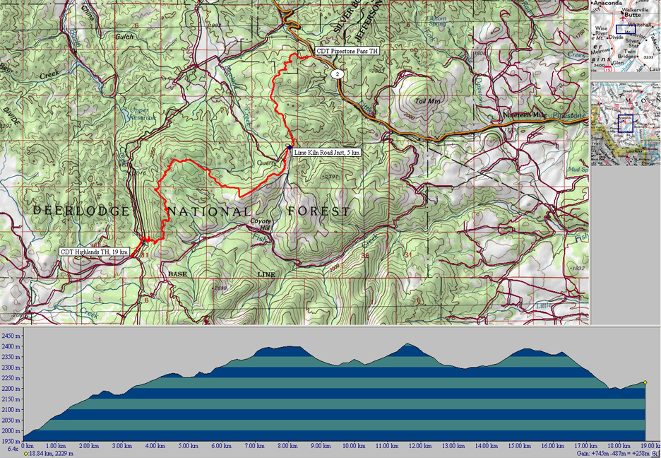
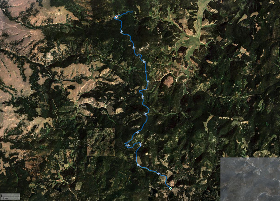
Continental Divide Trail (CDT)
Pipestone Pass to Highlands |
Topo
Photo |
19K.tpo |
19 km |
Moderate with standard USFS grades,
watch footing in small sections |
Memorial Day through Columbus Day |
|
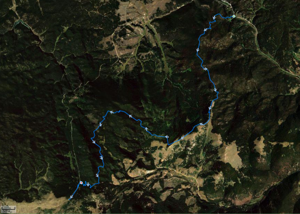
Continental Divide Trail (CDT) #87, Homestake
to Pipestone Pass |
Photo |
15K.tpo |
15 km |
Moderate with standard USFS grades and good footing |
Memorial Day through Columbus Day |
|
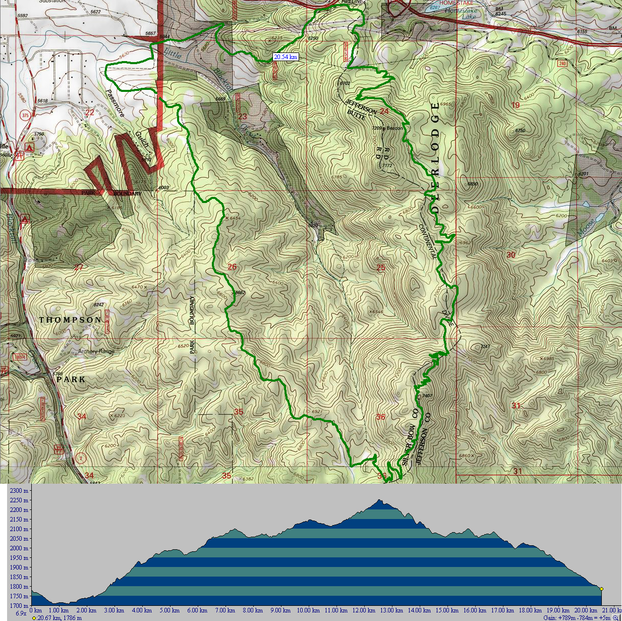
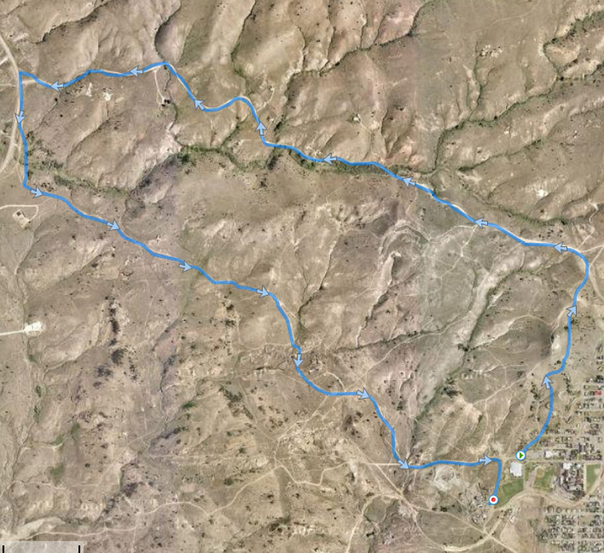
Blacktail Loop |
Topo
Photo |
21K.tpo |
21 km |
Big climb, then come back down. Difficult
navigation. |
Memorial Day through Columbus Day |
|
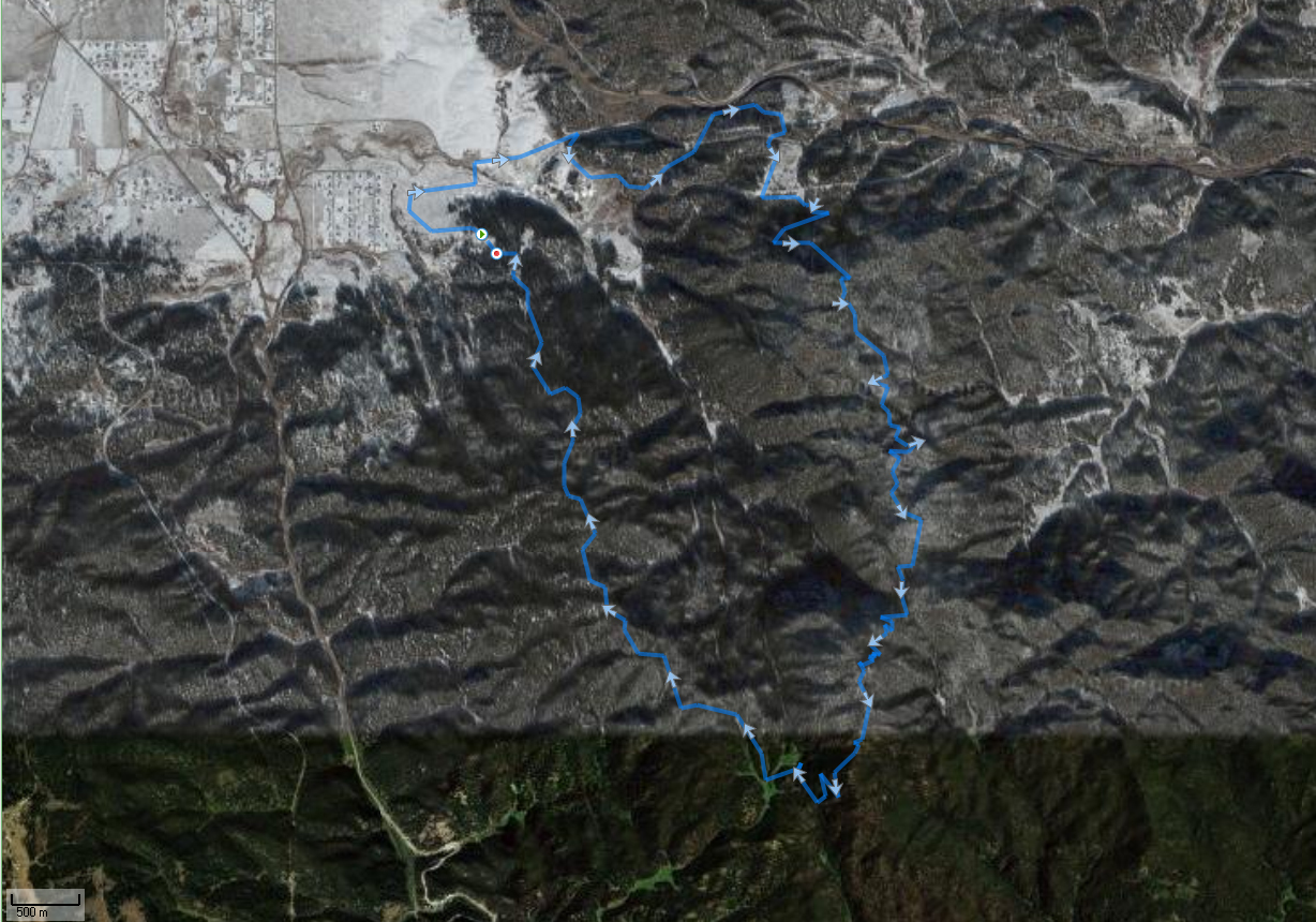
Continental Divide Trail (CDT), Homestake
to
Maude S Canyon Trail |
Topo
Photo |
20K.tpo |
20 km |
Moderate with standard USFS grades and good footing
on the CDT, but with a few short steeper pitches on the Maude S Trail. |
Memorial Day through Columbus Day |
|
Maude S Canyon to Lady of the Rockies |
Topo
Photo |
12K.tpo |
12 km one way |
Big climb, then come back down. |
Memorial Day through Columbus Day |
|
Lady of the Rockies Road |
Topo
Photo |
9K.tpo |
9 km one way |
Big climb, then come back down. |
Memorial Day through Columbus Day |
|
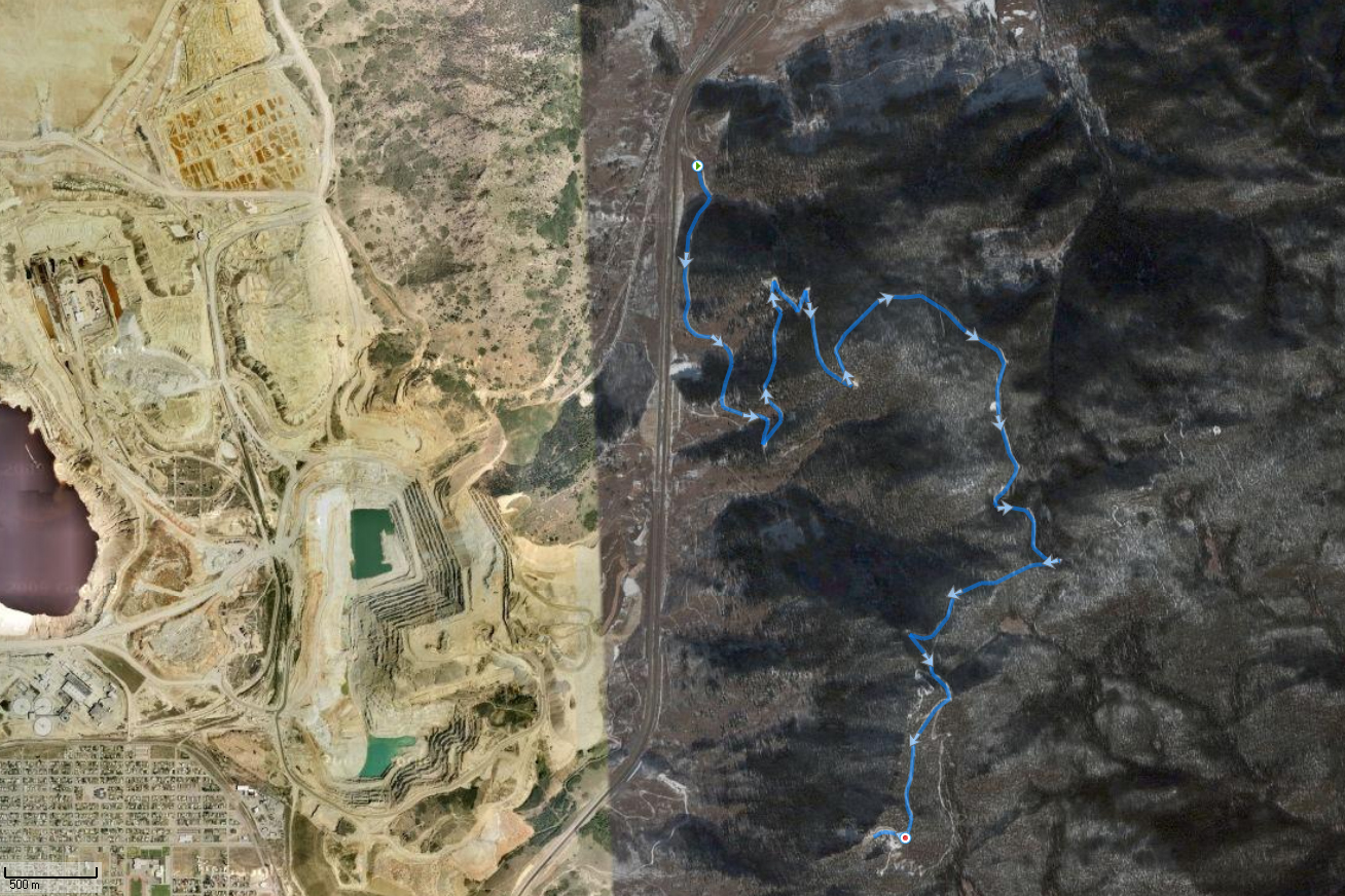
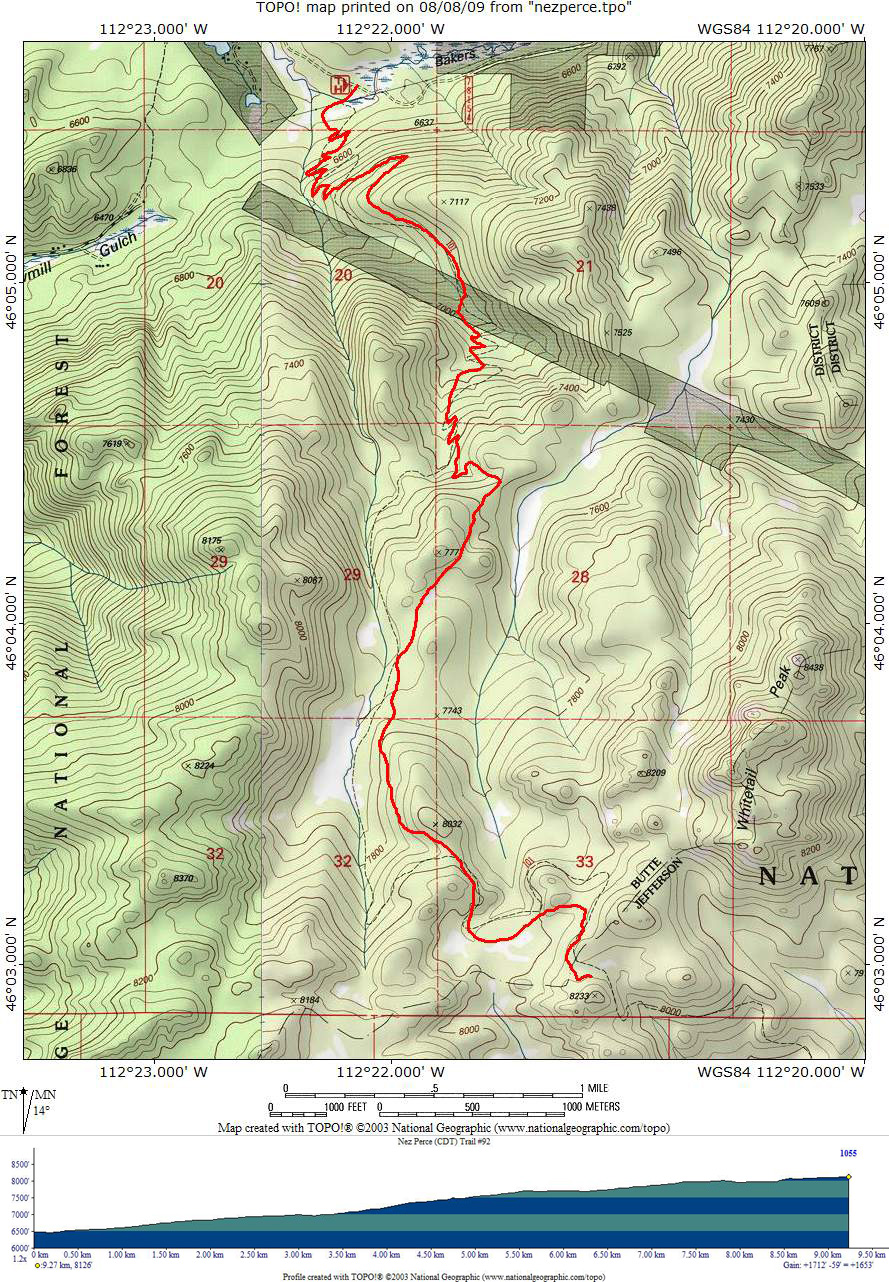
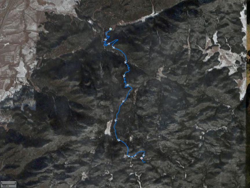
Nez Perce Continental Divide Trail (CDT) #92 |
Topo
Photo |
20K.tpo |
20 km |
Moderate with standard USFS grades,
watch footing on descent near bottom |
Flag Day through Columbus Day,
typically with patchy snow and some
mud at higher elevations in mid June |
|
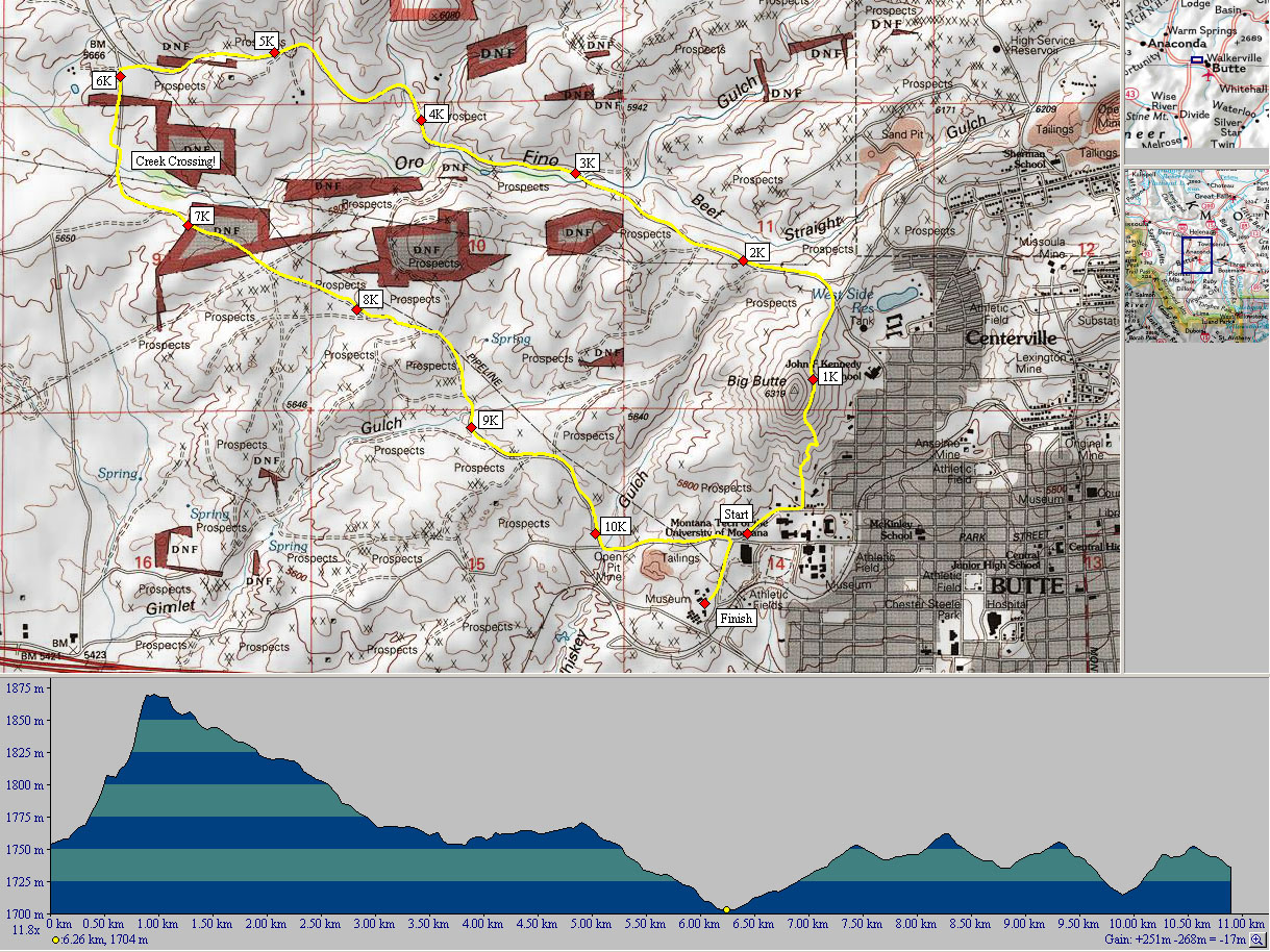
Montana Tech - Big Butte 11 K |
Topo
Photo |
11K.tpo |
11 km |
Starts with a big climb to the
"M" but moderate and rolling thereafter. |
All year
but portions often ice-packed and rough during winter |
|
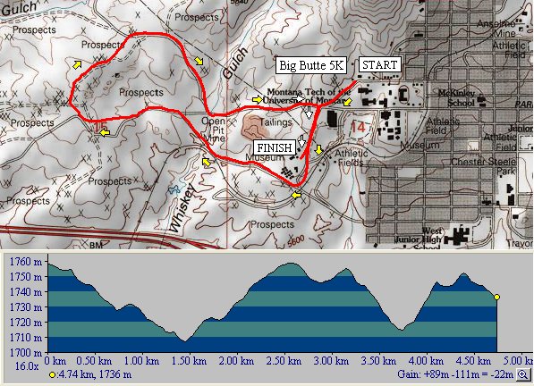
Montana Tech - Big Butte 5 K |
Topo
Photo |
5K.tpo |
5 km |
Moderate and rolling. |
All year
but portions often ice-packed and rough during winter |
|
Montana Tech - Frigid Digger 3 Mile |
Topo
Photo |
3mile.tpo |
~5 km |
Moderate and rolling. |
All year
but portions often ice-packed and rough during winter |
|
Montana Tech - Frigid Digger 7 Mile |
Topo
Photo |
7mile.tpo |
~11 km |
Moderate and rolling. |
All year
but portions often ice-packed and rough during winter |
|
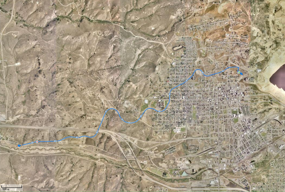
Westside Rail Trail |
Topo
Photo |
7K.tpo |
7 km one way |
Standard railroad grade hill |
All year
but portions often ice-packed and rough during winter |
|
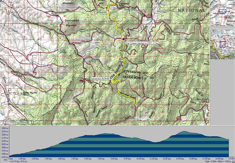
American Gulch to Champion Pass |
Topo
Photo |
17K.tpo |
17 km |
Moderate with 260 m net (600 m gross) altitude gain
on
road and trail |
June through October, with snow and ice lingering in areas of northern
exposure |