|
Butte's Piss & Moan Runners' guide to runable roads/trails in our area.
Each trail includes directions to the site, and a brief description of the
trail. |
|
Trail |
Map |
GPS Route |
Length |
Difficulty Rating |
Normally Free of Snow |
|
Bull Ranch (CDT) |
Topo
Photo |
9K.tpo |
6 km or
9.3 km |
Moderate with standard USFS grades and good footing except for a few rough
spots |
Memorial Day through Columbus Day |
|
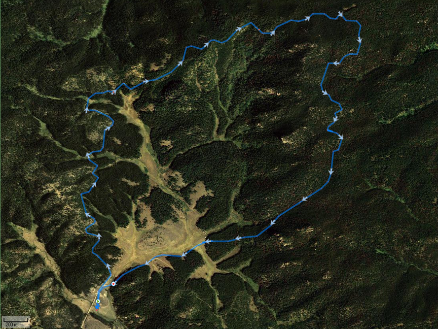
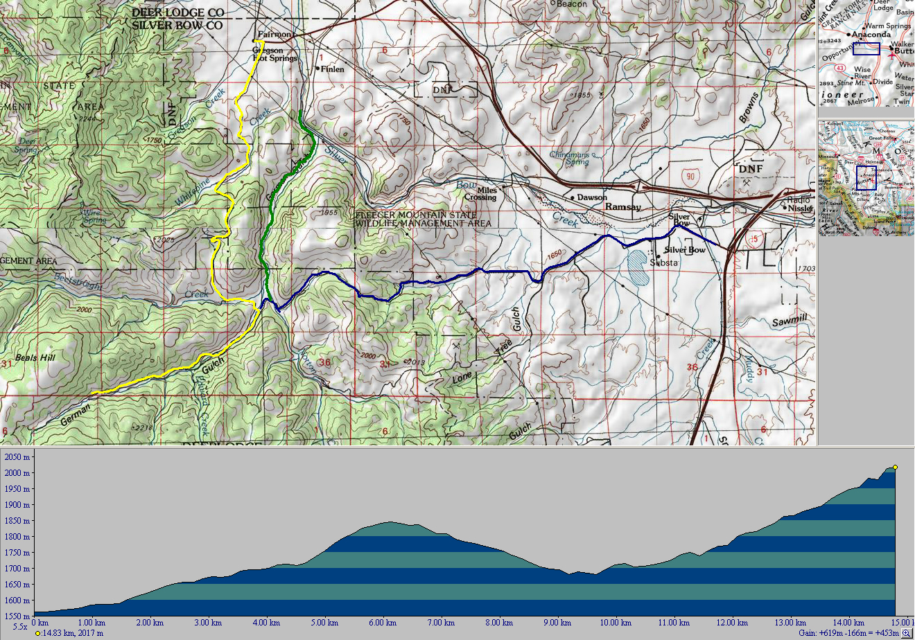
German Gulch |
Topo
Photo |
15K.tpo |
15 km or
other |
Difficult with some steep climbs on good footing,
with alternative routes. |
15 May through 1 December |
|
Stumptown Road
west out of Anaconda |
Topo
Photo |
6K.tpo |
6 km
|
Easy climb, mostly on dirt with areas of
protection from wind. |
All year. |
|
Lost Creek State Park |
Topo
Photo |
19K.tpo |
Up
to 19 km
|
Moderate climb, on dirt with areas of
protection from wind. |
1 May to snow season. |
|
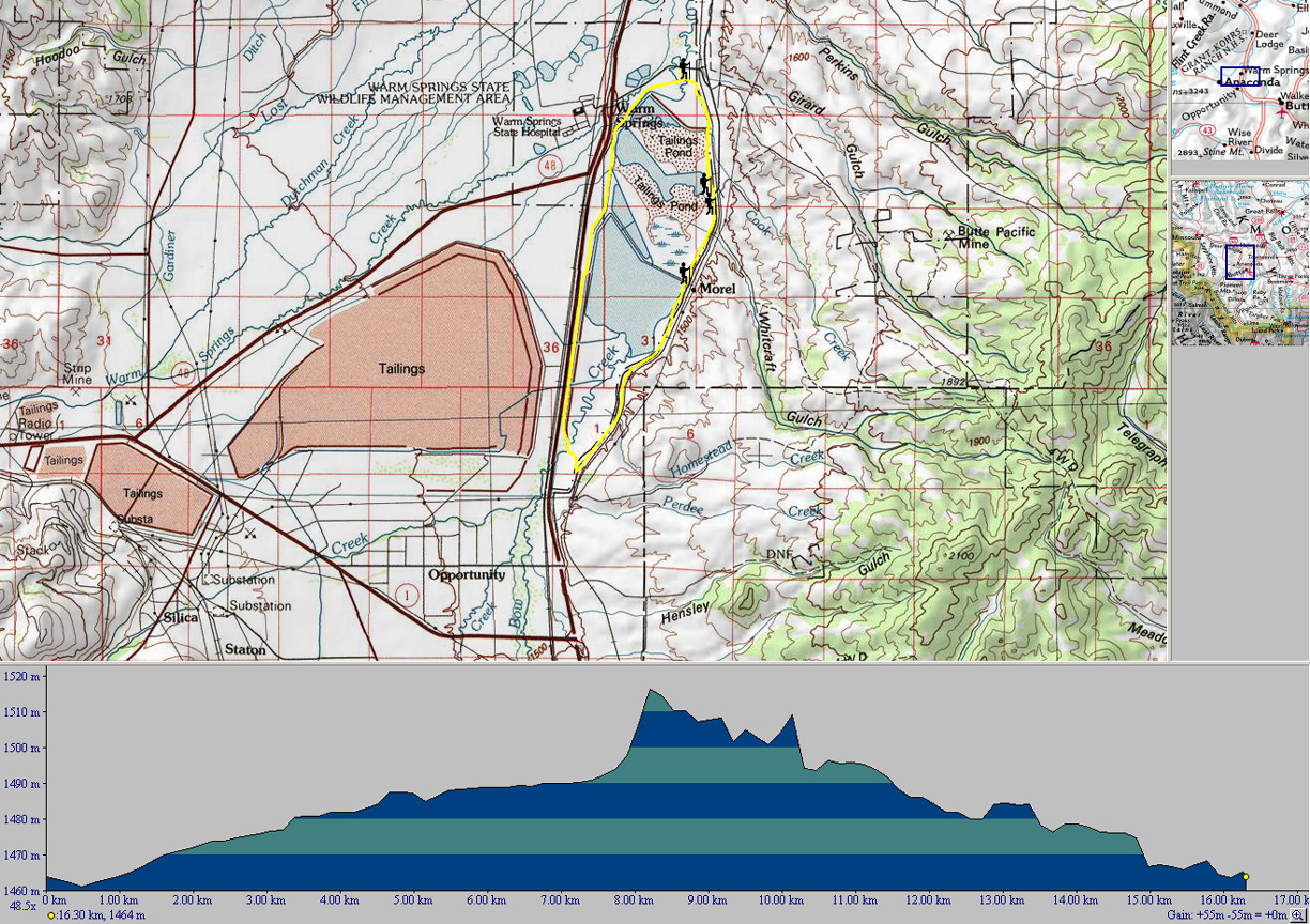
Warmsprings Pond |
Topo
Photo |
16K.tpo |
Up to 16
km |
Easy loop (except on windy days) with only 50 meters
elevation change. |
All year. |
|
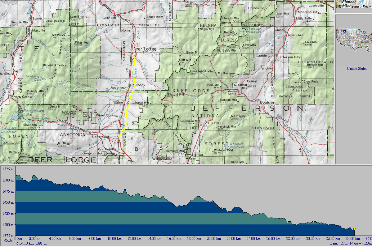
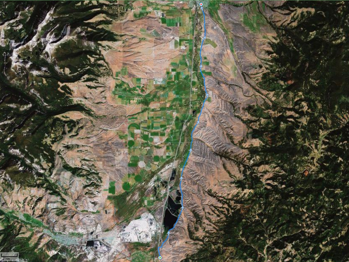
Opportunity to Deer Lodge |
Topo
Photo |
34K.tpo |
Up to 34
km |
Easy point to point (good for windy days) with
rolling hills and a net -0.3% grade when run S to N. |
All year. |
|
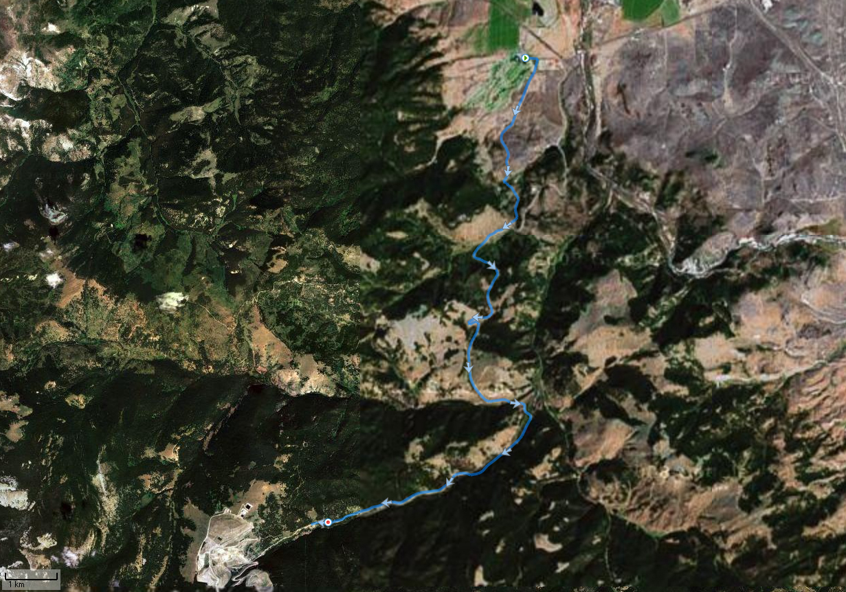
Dry Cottonwood Canyon |
Topo
Photo |
19K.tpo
19K.kmz |
19 km or other |
Loop on moderate grade dirt road
with a couple steep climbs.
Parts muddy in wet conditions. |
All year, but with possible drifted snow on
uppermost section from December through March. |
|
Race Track
Canyon Road |
Topo
Photo |
20K.tpo |
Up to 20 km
|
Moderate to difficult climb, on dirt. Parts
muddy in wet conditions. |
May to October, but with snow lingering much longer
on the uppermost section. |
|
Bielenberg
Canyon Road |
Topo
Photo |
20K.tpo |
Up
to 36 km
|
Moderate to difficult climb, on dirt. Parts
muddy in wet conditions. |
May to October, but with snow lingering much longer
on the uppermost section. |
|
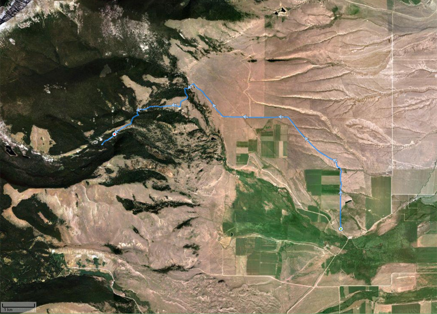
Mount Powell Trail Head |
Topo
Photo |
12K.tpo |
12 km |
All up hill on moderate grade dirt road.
Parts muddy in wet conditions. |
May through November.
All year up to tree line at 7 km. |
|
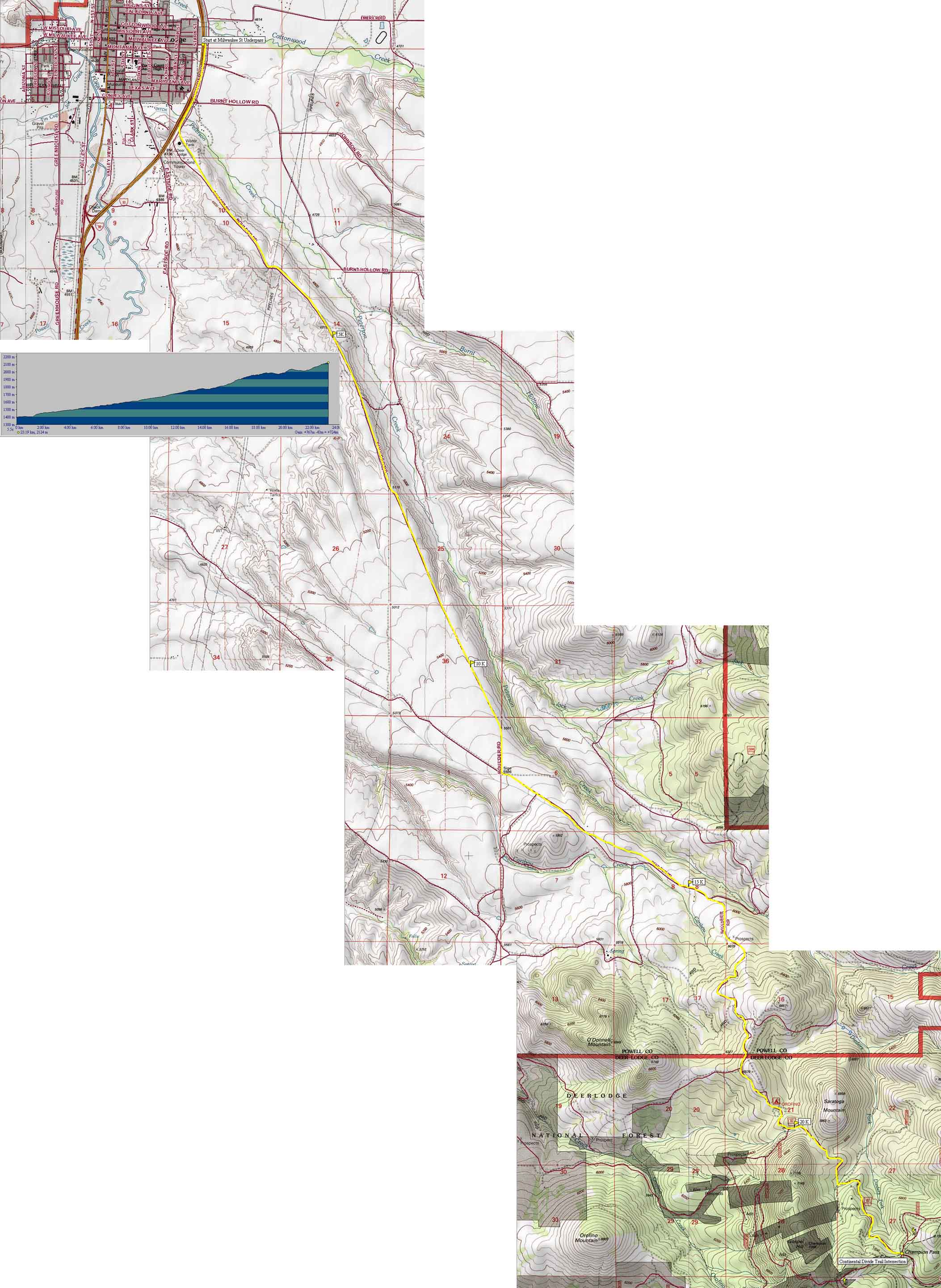
Boulder Road from Deer Lodge to
Champion Pass (CDT x-ing) |
Topo
(4.3MB) |
23K.tpo |
Up to 23 km |
All up hill on moderate grade. Paved for 2 km then dirt road for the rest.
Gets muddy in wet conditions. |
Memorial Day through Columbus Day.
All year up to snowmobile parking area at 15 km. |
|
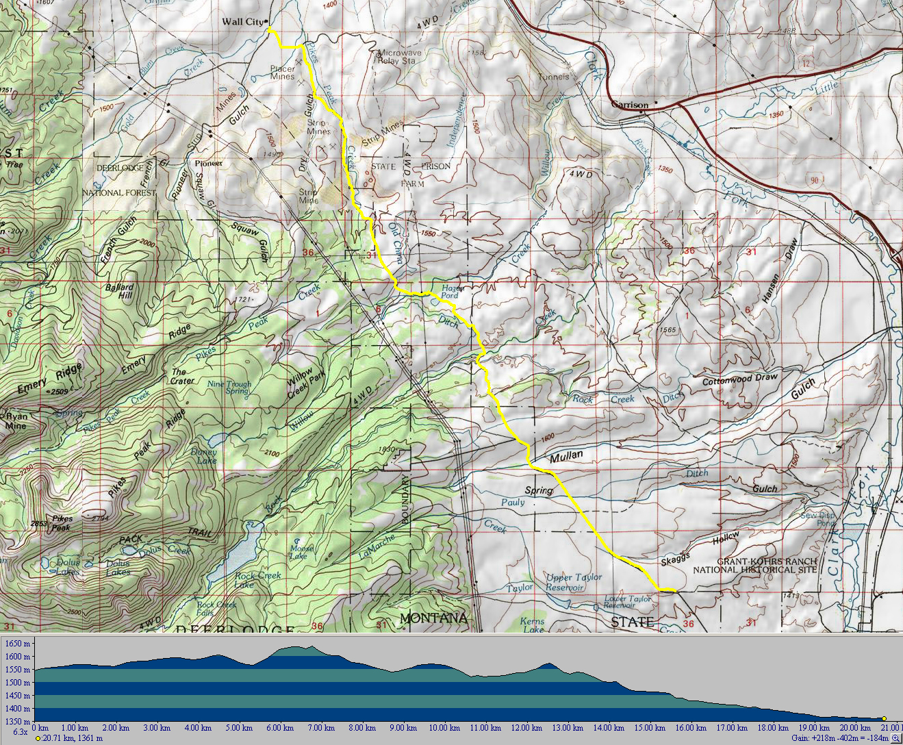
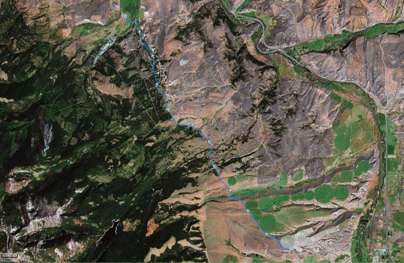
Old Stage Road from Deer Lodge to
Gold Creek |
Topo
Photo
|
21K.tpo |
Up to 21 km |
Moderate point to point with rolling hills and a net
downhill grade. |
April through November. All year up to fork at 6 km. |
|
Spotted Dog Wilderness NE of Deer Lodge |
Topo
Photo
|
16K.tpo |
16 km or any
distance |
As hard as you like. |
1 May to snow season. |